

| Total Caribbean islands | Approximately 700+ (General geographic consensus) |
| Only US territory in the Caribbean | Puerto Rico (commonwealth), plus USVI (U.S. Government) |
| Hurricane season dates | June 1 - November 30 (National Hurricane Center, NOAA) |
| Driest, most visited season | Mid-December through April (Caribbean Tourism Organization) |
| Sunniest island (fewest rainy days) | Aruba - averages roughly 21 inches of rain per year (General climatological data) |
| Southernmost major hurricane-sheltered islands | Aruba, Bonaire, Curaçao (ABC Islands) (NOAA historical storm track data) |
How to Use This Guide
The Caribbean isn't one destination - it's hundreds. Choosing the right island often comes down to matching your travel priorities: Do you want dramatic volcanic peaks or flat, reef-lined beaches? Bustling nightlife or quiet fishing villages? A quick direct flight from a US gateway or a more off-the-beaten-path arrival? This guide breaks down standout destinations by those exact filters so you can scan, compare, and shortlist with confidence.
Before diving in, note that entry requirements, transportation options, and local conditions can change. Always verify travel advisories, visa rules, and health requirements with official government sources before booking. For deeper context on how terrain shapes the actual on-the-ground experience at any destination, see why geography shapes what travelers encounter.
| Total Caribbean islands | Approximately 700+ (General geographic consensus) |
| Only US territory in the Caribbean | Puerto Rico (commonwealth), plus USVI (U.S. Government) |
| Hurricane season dates | June 1 - November 30 (National Hurricane Center, NOAA) |
| Driest, most visited season | Mid-December through April (Caribbean Tourism Organization) |
| Sunniest island (fewest rainy days) | Aruba - averages roughly 21 inches of rain per year (General climatological data) |
| Southernmost major hurricane-sheltered islands | Aruba, Bonaire, Curaçao (ABC Islands) (NOAA historical storm track data) |
Islands by Terrain and Landscape
Caribbean islands broadly fall into two geological categories: high volcanic islands with lush interior mountains, and low-lying limestone or coral islands with flat terrain and wide sandy coastlines.
- Dominica: Dense rainforest, boiling lake, world-class diving. Minimal resort development - best for nature-first travelers.
- St. Lucia: The twin Piton peaks, waterfalls, and jungle trails paired with a developed resort corridor on the northwest coast.
- Jamaica: Central Blue Mountains (good for coffee hikes), northern coast beaches, and interior rivers offering tubing and waterfalls.
- Aruba: Flat, arid, and almost always sunny - cacti, natural pools, and consistent trade winds. Zero rainforest.
- Turks and Caicos: Ultra-flat coral islands with some of the most vivid shallow-water flats in the hemisphere, ideal for beach relaxers and snorkelers.
- Puerto Rico: Rare combination - a bioluminescent bay, El Yunque rainforest, karst limestone hills, and urban San Juan, all in one US territory.
High island
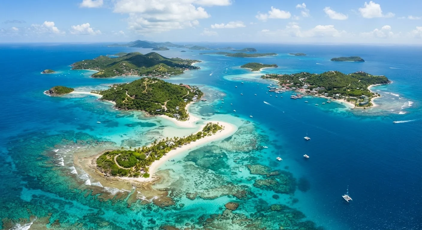
A volcanic island with significant elevation, interior mountains, and typically lush vegetation. Examples include Dominica, St. Lucia, and Martinique.
Low island
A flat, coral- or limestone-based island with limited elevation. These tend to be drier and are known for wide beaches and clear, shallow water - like Aruba or the Turks and Caicos.
Hurricane belt
The region of the Atlantic and Caribbean where tropical storms and hurricanes most commonly develop and travel. Most of the Caribbean sits within this belt during the Atlantic hurricane season.
Regional hub airport
A larger Caribbean airport - such as those in Barbados, Puerto Rico, or St. Maarten - that serves as a connection point to smaller islands with limited direct international service.
Bioluminescent bay
A rare natural phenomenon where microscopic marine organisms (dinoflagellates) cause the water to glow blue-green when disturbed. Puerto Rico has three of the world's few accessible bioluminescent bays.
Islands by Vibe and Travel Style
Atmosphere matters as much as scenery. Here's a fast-reference breakdown of prevailing vibes across major island groups.
| Island / Territory | Prevailing Vibe | Best For |
|---|---|---|
| Barbados | Sophisticated, historically rich, lively West Coast dining scene | Culture seekers, culinary travelers |
| St. Barts | Upscale, boutique, low-key luxe | Quiet, high-end escapes |
| Trinidad | Carnival, steelpan, and vibrant Creole culture | Festival travelers, food lovers |
| Cayman Islands | Polished, family-friendly, strong dive infrastructure | Divers, families, first-timers |
| Grenada | Spice-scented, unhurried, approachable | Off-the-beaten-path seekers |
| Cuba | Historic colonial cities, vintage aesthetic, music-rich | History buffs, culture immersion |
Note that entry requirements for US citizens traveling to Cuba involve specific federal regulations - consult the U.S. Department of Treasury and State before planning any trip there.
Cuba Travel: US Regulations Apply
US citizens face specific federal restrictions on travel to Cuba under Treasury Department licensing categories. General tourism is not among the permitted categories under current regulations. Travelers should review the most current guidance from the U.S. Department of State and the Office of Foreign Assets Control (OFAC) before making any plans. Requirements can and do change.
Accessibility from US Gateways and Best Travel Periods
Flight time and seasonal timing are two of the biggest cost and comfort levers for US-based Caribbean travelers. For a broader look at cost patterns by region, this region-by-region cost overview provides useful context.
- Closest to the US East Coast (under 3.5 hours nonstop): Puerto Rico, Dominican Republic, Jamaica, Turks and Caicos, The Bahamas. These often have the widest flight options and competitive airfares.
- Mid-range (4-5 hours): Barbados, St. Lucia, Aruba, Trinidad. Fewer direct routes from secondary US cities.
- Further East (5+ hours or connections likely): Dominica, Grenada, St. Barts. Small airports may require a connection through a regional hub like Barbados or St. Maarten.
Peak season runs mid-December through April, when rainfall is lowest and demand (and pricing) is highest. Hurricane season officially spans June 1 through November 30, with the most active period typically August through October. The southern Caribbean - Aruba, Curaçao, and Trinidad - sits below the primary hurricane belt and historically sees less storm activity, though no area is entirely exempt. Always review current-season forecasts and consider travel insurance options carefully.
For a structured approach to verifying all of this before you book, experienced travelers' research habits outlines how to cross-check advisories and local conditions confidently.